| Location |
Forecast |
Satellite |
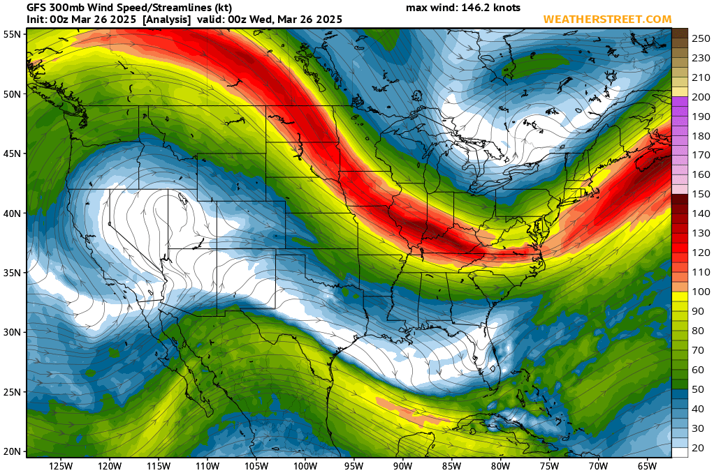
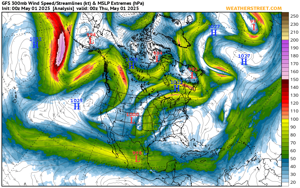
Jet Stream |
Radar |
Lightning & sky |
Air quality |
Drought & Fire Info. |
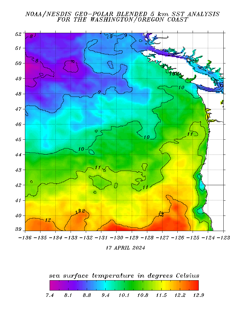
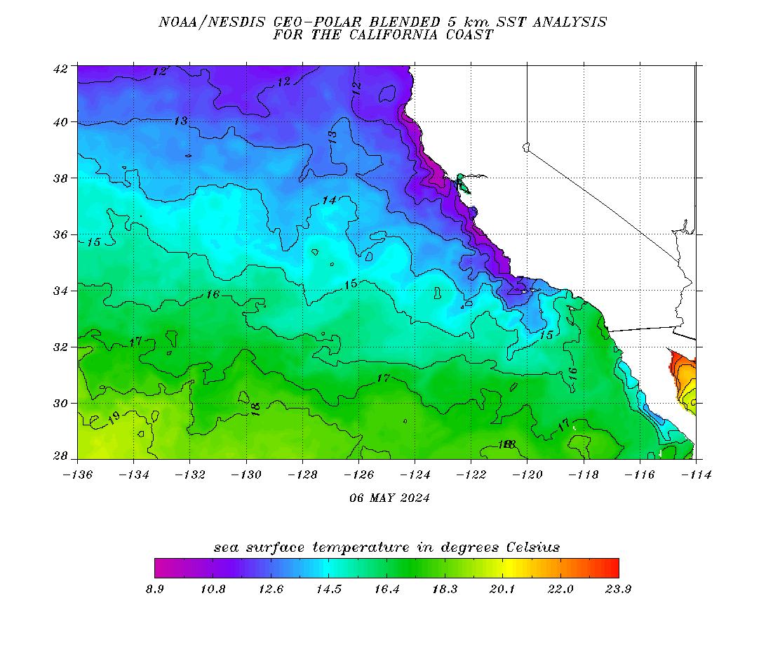
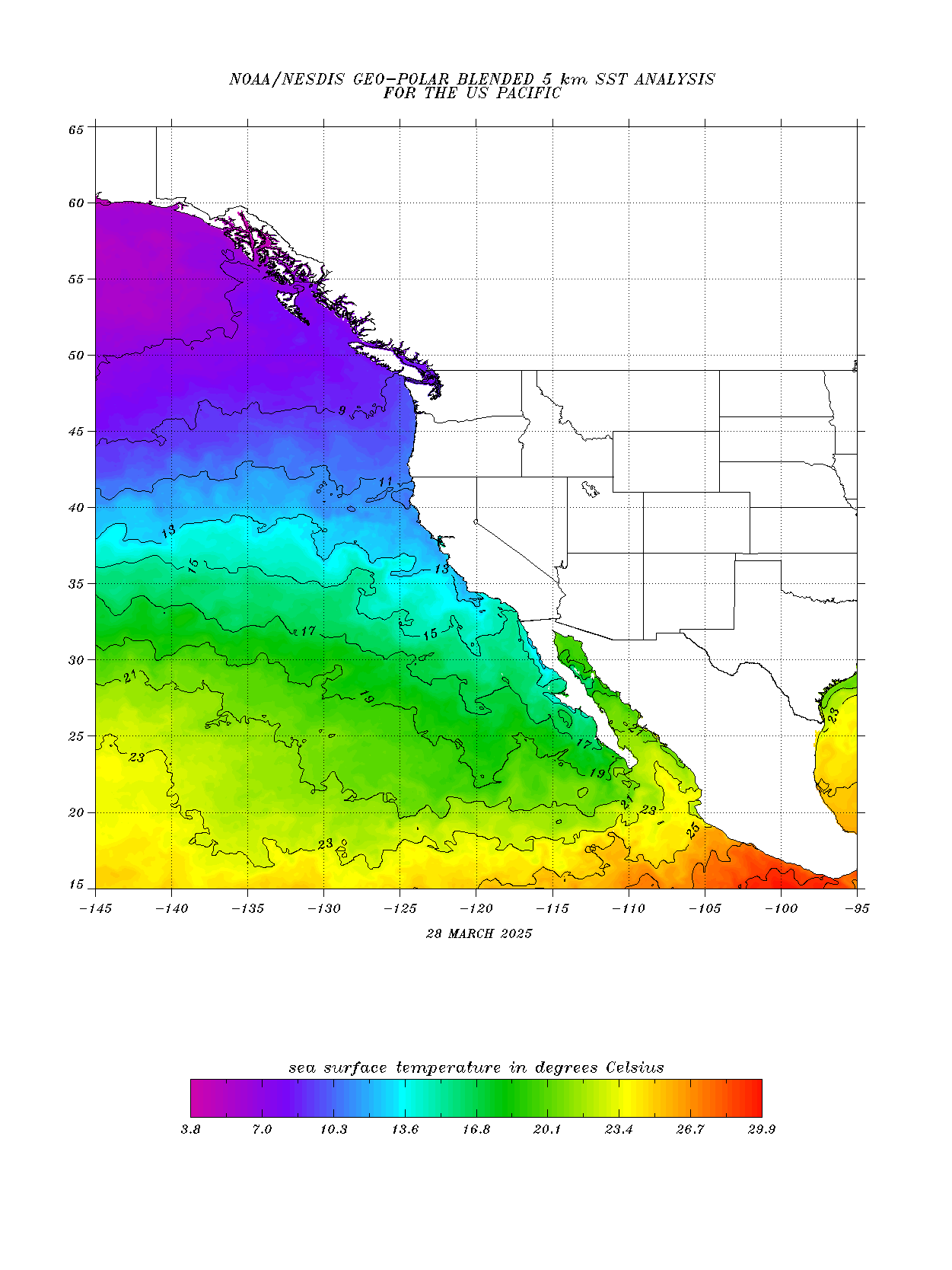
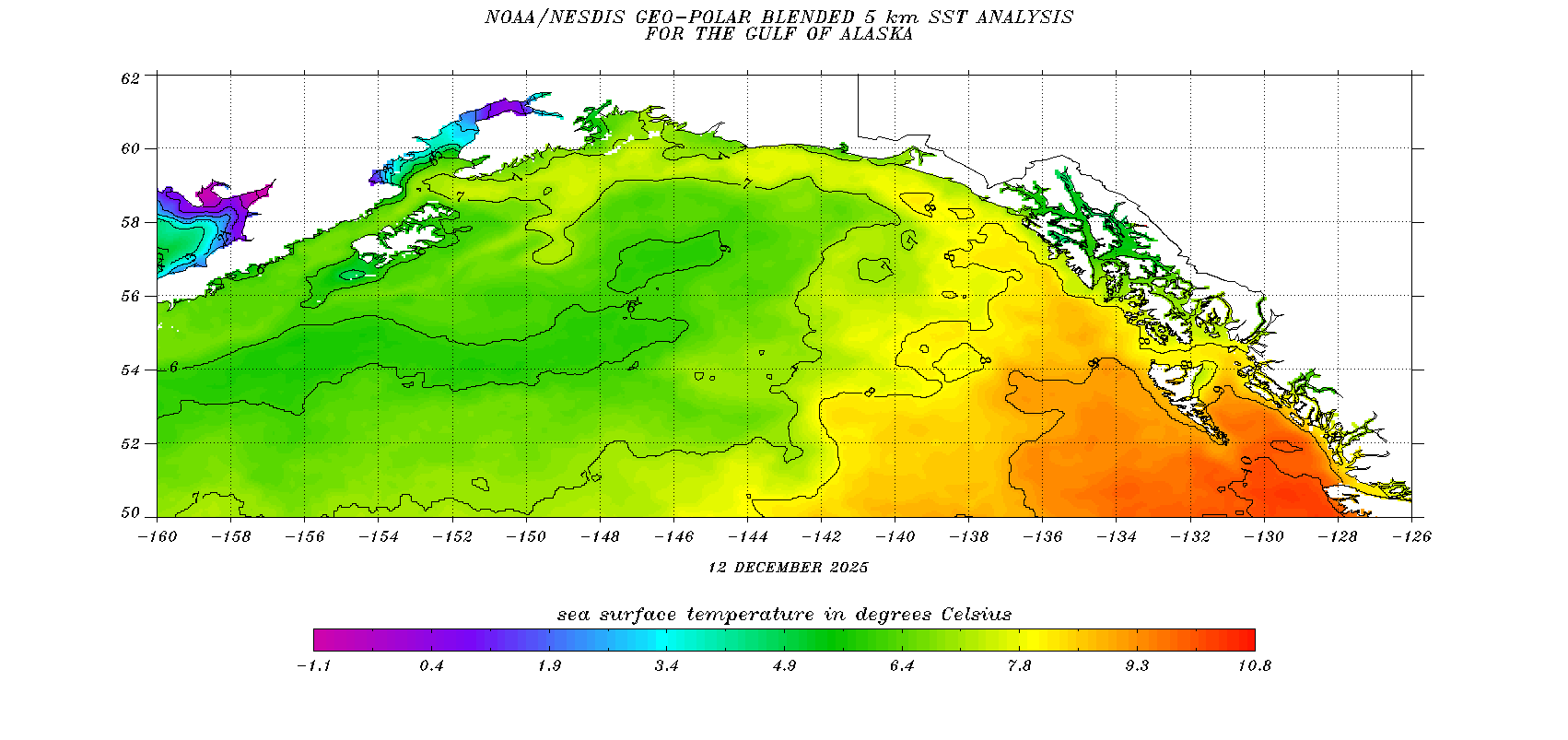
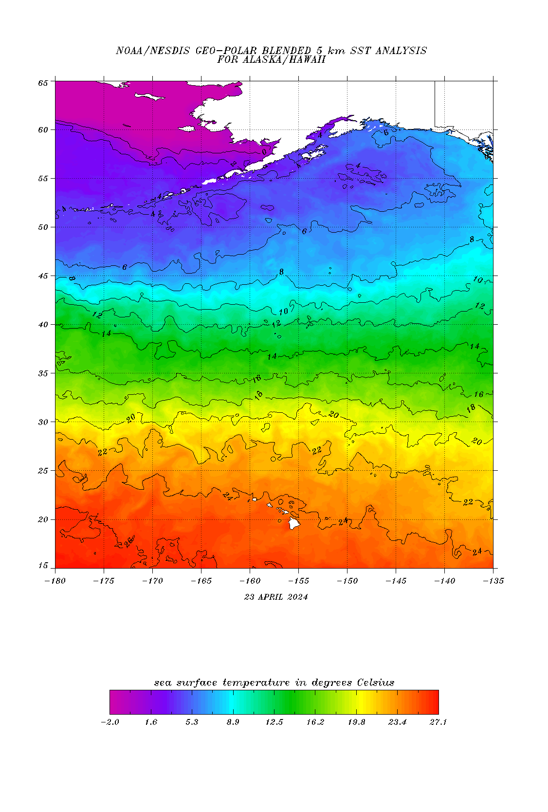
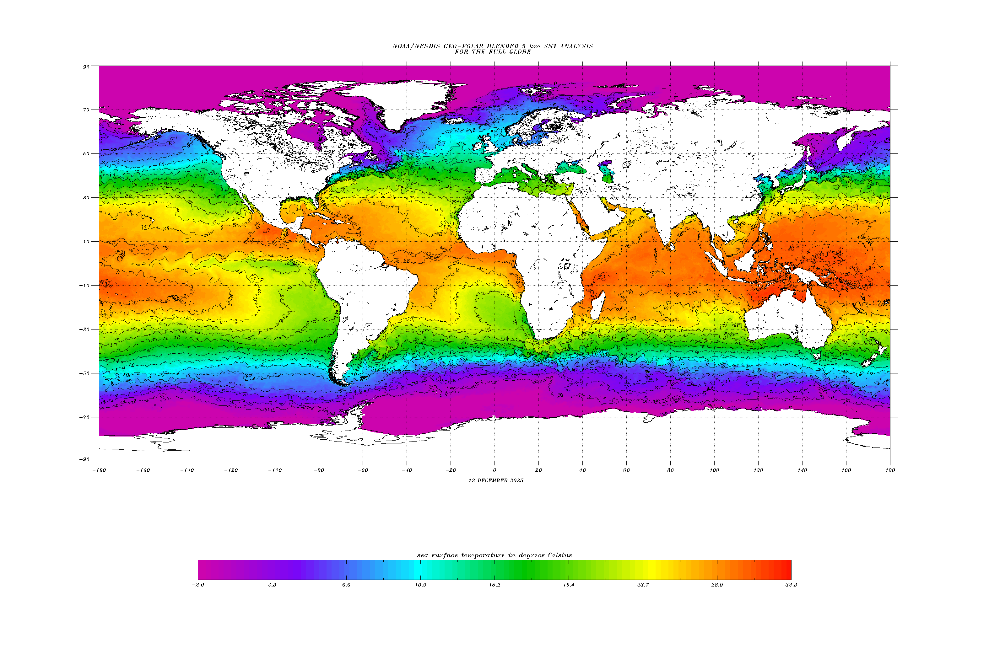
Sea Surface Temps |
Earthquake
& Tsunami |
| Low Bandwidth |
Santiam Pass |
n/a |
CONUS
North America
c/o www.weatherstreet.com
|
n/a |
North America
c/o www.lightningmaps.org
|
Look outside |
Look outside |
Washington, Oregon |
| Santiam Pass |
Santiam Pass
7-day /
14-day
Current map
|
n/a |
n/a |
Portland weather radar -
Full area & near
Santiam Pass
|
Lightning
Central Oregon
Oregon
Dark Sky map
Night Sky Tonight
Use "97759" for "Place"
|
Sisters, OR
Camp Tamarack
Hoodoo Ski Area
|
Oregon Smoke Information
ODF Wildfire News &
Blog
Fire Aware, Fire ...
c/o OSU Extension Service
Oregon Flora - plants |
n/a |
Washington
Oregon
N. California |
| Pacific NW |
Forecast zones |
GOES 17 "GeoColor"
static /
loop |
Windy.com |
NWS - zoom on
PNW
UofW - PNW radar
|
Pacific NW |
Central Oregon
Sisters
Oregon DEQ
|
NWCC Large fire map
AlertWildFire cameras
AlertWildFire - Smith Ridge
Drought map - Oregon &
Slider
|
Washington, Oregon |
Pacific NW |
| Western US |
Forecast zones |
GOES 17 "GeoColor"
static /
loop
UofW -
Vis,
IR,
WV
|
n/a |
n/a |
Pacific SW |
n/a |
Drought map - West Coast |
California |
S. California |
| Continental US |
Forecast zones
Forecast
Wx Chart
|
GOES-EAST
static /
loop
wunderground - IR
|
Current:
CONUS
North America
Forecast:
North America
|
CONUS |
Lightning
Dark Sky maps
|
North America |
Inciweb - Incident info.
NFSA Tool - map
Drought map - National &
Slider
|
North America
east of 145W |
CONUS
& Click on
"Nearby Places"
USGS
|
| North Pacific |
n/a |
GOES 17 "GeoColor"
static /
loop
UofW -
Vis,
IR
enhanced
|
North Pacific
(interactive)
|
n/a |
n/a |
n/a |
n/a |
Alaska
Alaska-Hawaii
west of 135W |
N. Pacific |
| Hemisphere, World-wide |
Space Weather
Aurora forecast
|
GOES-WEST Pacific
GOES-EAST Atlantic
|
Forecast (interactive) |
n/a |
Lightning
Aurora Borealis
Moon phase
|
Worldwide |
n/a |
Worldwide
Chart collection
|
Earthquake
USGS
Tsunami
|