- Home
- /
- Member Home
- /
- MTR
Mountain Travel and Rescue at Santiam Pass, Oregon
Courses presented by National Ski Patrol certified instructors
There is no such thing as bad weather, only unsuitable clothing.
Alfred Wainwright
Requirements for credit:
- MTR 1 – FEMA ICS-100: Introduction to the Incident Command System
- MTR 1 – FEMA IS-700: National Incident Management System, An Introduction
- MTR 2 – FEMA ICS-200: ICS for Single Resources and Initial Action Incidents
- https://training.fema.gov/nims/
- https://training.fema.gov/emiweb/is/icsresource/trainingmaterials.htm
- Send your certificates of FEMA course completion to your instructor for full course credit.
- Avalanche 1 (and 2) is helpful but not required.
MTR 2 requires successful completion of MTR 1 and AVY 1. You must complete MTR 1 before taking MTR 2.
MTR 1 has a field day and an overnight, improvised shelter outing – 2 days and 1 night. This 2024 year, because our students were coming in from long-distance, we rolled the field day into the overnight by setting up the night before and starting early.
MTR 2 has a two-night outing – 3 days and 2 nights.
Textbooks
- Mountaineering: Freedom of the Hills, 9th edition (2018)
- NASAR: Introduction to Search and Rescue (2008)
- We no longer use: Mountain Travel & Rescue: National Ski Patrol’s Manual for Mountain Rescue (2012). If you have one, it contains an abundance of useful information
- Texbooks are optional. You can find all or most of the information online
Syllabus
About MTR
MTR is the knowledge and skills of mountain travel and rescue. This includes:
- Navigation
- Topographic maps
- Coordinate systems and datum
- Compass
- GPS – handheld and phone
- Mountain travel
- Dressing for various outdoor weather conditions
- Modes – AT/skins, snowshoes
- Route selection
- Hazard awareness and mitigation
- Self-contained or as part of a team
- Camping
- Sleeping systems
- Cooking systems
- Handling waste
- Emergency bivouac
- Improvised shelter
- Fire building
- Search and rescue
- Rope rescue
- Rope craft: Relevant knots, hitches, and bends
- Rope systems and management
- Anchors – SERENE
- Raising and lowering
- Rope management
- Patient care
Credit requirements
- Complete all prerequisites as listed above
- Attend 4 online sessions
- Complete all online google form worksheets
- Successful completion of the overnight session
- Two days and one night out
- Demonstrate skills as covered in the online sessions and google forms
Section A
- Search and rescue basics – see intro to SAR
- See the 50 (70) skill check list
- GPS, maps and compass
- See the Day 1 worksheet below
Section B
- GPS, map and compass continued
- Coordinate systems
- Compass declination
- Ropecraft: Knots, bends, and hitches
- See the Day 2 worksheet below
Section C
- Body temperature regulation
- Water and hydration
- Nutrition
- Clothing
- Sleeping systems
- Shelter – focus on improvised
- Fire for warmth and my brand new $400 shell
- Hazards and scene safety for travel
- Patient transport
- Route planning
- See Day 3 worksheet below
Section D
- A rope rescue system
- Preparing for the over-night outing
- Equipment
- Pack as if you were going on a “normal” out-of-area SAR
- With an overnight and shelter-in-place kit
- Everyone will shelter a patient or two overnight
- Avy kit: probe, beacon, shovel
- Trailhead protocols
- Sign-in
- Equipment
- Weather and avalanche review
- Travel, parking (snopark, trail pass), lodging
- Fitness
- Date
- Rain? Illness?
- Schedule Day 1
- Trailhead protocol
- Travel in
- Review and student demonstrations
- Establish “camp”
- Night SAR
- Schedule Day 1
- Continue review and student demonstrations
- Break camp
- Travel out
- Wrapup
- Equipment
- See Day 4 worksheet below
Dates for 2024
- Online – 1900-2100 PT
- 7-9 PM PT
- 8-10 PM MT
- 9-11 PM CT
- 10-12 PM ET
- Jan 9
- Jan 16
- April 8
- April 15
- Overnight May 11-12
Worksheet links for 2024
It is not the mountain we conquer, but ourselves.
Sir Edmund Hilary
Overnight
- Dates – May 11-12
- Meeting location – Probably Santiam Pass, OR
- Schedule – Saturday 0800 – Sunday 1600
- Concept
- Your kit
- Pack as light as you can, but have what you need
- What you wear or carry in your pack
- Remember to bring avalanche gear:
- Shovel
- Probe
- Transceiver (We have extra if you do not have one)
- No pokes, sleds, or sherpas allowed
- You need to be able to pack up your kit and move as needed
- You do not need to improvise sleeping gear – bring a warm bag and foam pad(s)
- Skis or snowshoes
- You will be grouped into twos or threes for gear and shelter
- You will coordinate with your group mates on community gear
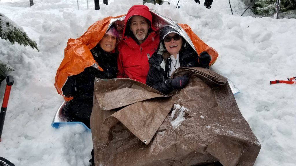
- Improvised shelter
- Cooking
- First Aid
- Navigation
- You will “shelter-in-place” each other in your group
- You do as a team the shelter, SAR, rope craft, and navigation exercises
- Each of you will get to take the role of Incident Command and planning
- You will coordinate with your group mates on community gear
- Your kit
Overnight 2024
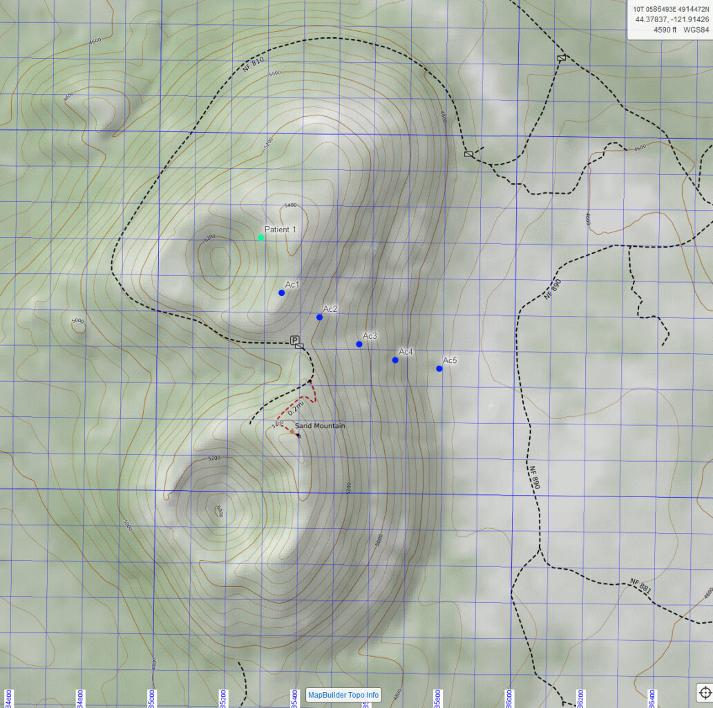
Map
Geospatial PDF 1:24,000
Geospatial PDF 1:12,000
- https://caltopo.com/m/EUPDM – this may not show correctly, but the markers may show coordinates when tapped
Hoodoo Weather